Tom Froese, Illustrator, London
Associated creatives

Tags
Description
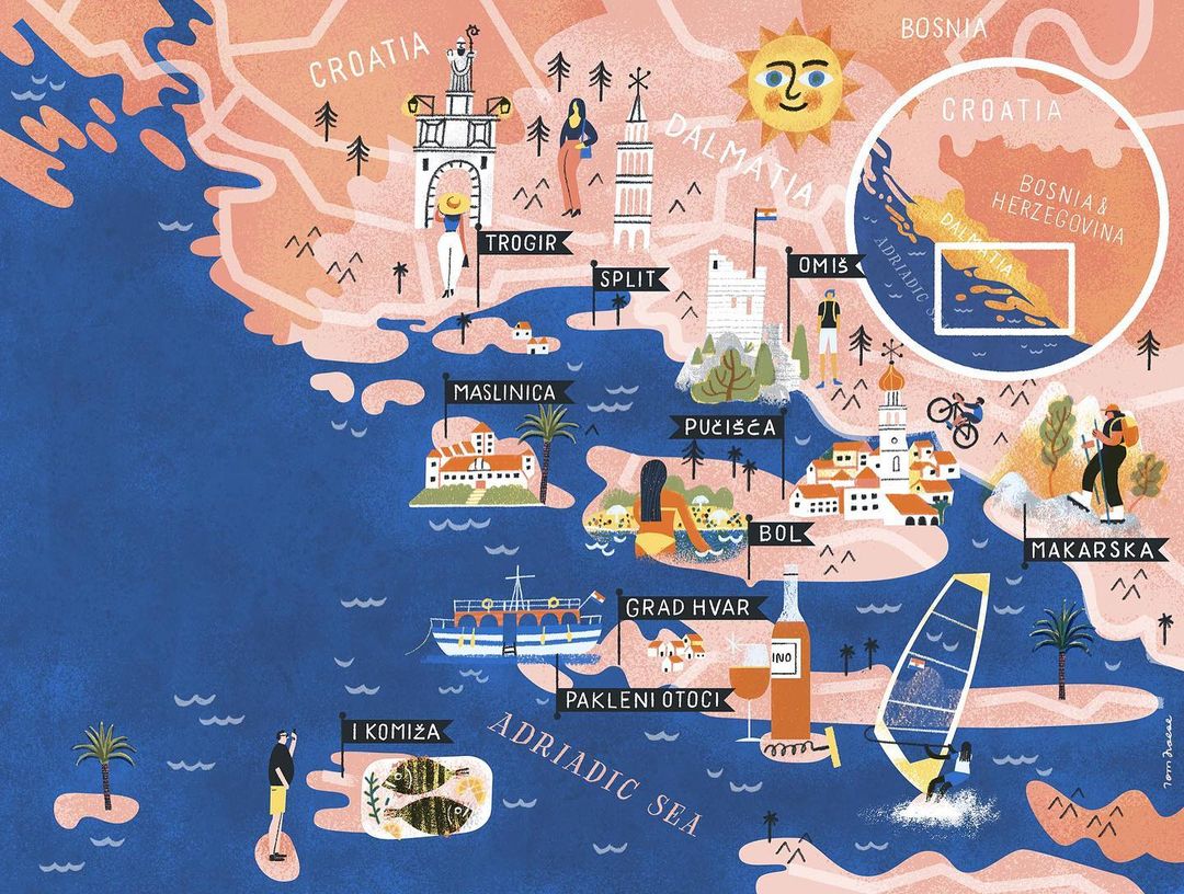
This illustration features a map of Croatia and Dalmatia with key cities identified by name, including Split, Trogir, Omis, Maslinica, Bol, and Makarska. Landmarks and notable features are depicted within the landscape, showing local architecture and landscape. There are people engaging in various activities such as walking, cycling, swimming, and windsurfing. A bottle of wine and glass are illustrated near Grad Hvar. The Adriatic Sea is labeled, with various boats scattered throughout the water. The color palette includes shades of blue for the sea, peach and pink for the land, and other various colors for details. The sun is illustrated with a face.