
Stephanie Ginger, Illustrator, London
Associated creatives

Tags
Description
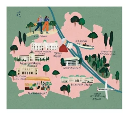
This illustrated map of Vienna, created by London-based illustrator Stephanie Ginger, presents a stylized aerial view of the city against a textured green background. The soft pink landmass is intersected by blue waterways representing the Danube, surrounded by distinctive green trees and landscaped parks. Prominent cultural and historical landmarks are illustrated across the composition, including the Vienna Imperial Palace, Belvedere Palace, and the Vienna State Opera, each labeled with handwritten typography. Small figures engage in activities like wine hiking and boating, while an airplane approaches Vienna International Airport in the corner. The piece uses a muted, warm color palette with textured grain finishes throughout.